Category:Kerk, Jannum Media in category "Kerk, Jannum"Navigation menu53° 18′ 45.56″ N, 5° 54′ 09.81″ EOpenStreetMapGoogle EarthProximityramaUpload media53° 18′ 46.01″ N, 5° 54′ 10.01″ EOpenStreetMapGoogle EarthProximityramaRijksmonument ID: 11688Europeana ID: 2020718/DR_11688ReasonatorScholiaStatisticsWikiShootMe11688
Buildings in JannumChurches in Noardeast-FryslânRijksmonumenten in JannumRomanogothic churches in the Netherlands1300s churches
Help
Category:Kerk, Jannum
Jump to navigation
Jump to search
| Object location | View all coordinates using: OpenStreetMap - Google Earth - Proximityrama |
|---|
.mw-parser-output #wdinfoboxwidth:210px;font-size:95%;table-layout:fixed;padding:0.mw-parser-output #wdinfoboxcaptionmargin-left:0px;background-color:white.mw-parser-output #wdinfobox thvertical-align:top;word-wrap:break-word.mw-parser-output #wdinfobox tdword-wrap:break-word.mw-parser-output .taxontree-lcell,.mw-parser-output .wikidatainfobox-lcelltext-align:right;background-color:#cfe3ff;padding-left:0.4em;padding-right:0.4em;font-weight:bold.mw-parser-output .taxontree-fullcelltext-align:center.mw-parser-output .taxontree-hdrcelltext-align:center;background-color:#cfe3ff;padding-left:0.4em;padding-right:0.4em;font-weight:bold.mw-parser-output .taxontree-rcell.mw-parser-output .taxontree-row@media screen and (max-width:600px).mw-parser-output .wdinfo_nomobiledisplay:none;visibility:hidden;height:0.mw-parser-output .wdinfobox_horizontalwidth:100%!important;clear:both!important;display:block;column-count:4.mw-parser-output .wdinfobox_hidedisplay:none.mw-parser-output #wdcreatordisplay:none.mw-parser-output .wdcreator_showdisplay:block!important.mw-parser-output #wdinfo_taxon ullist-style:none;padding-left:0;margin-left:0;list-style-position:inside.mw-parser-output .wikidatainfoboxVN ul lilist-style:none;padding:0;margin:0.mw-parser-output .wikidatainfoboxVNpadding:0;margin:0
 | |||
| Upload media | |||
| Instance of | church building | ||
|---|---|---|---|
| Location | Jannum, Ferwerderadiel, Friesland, Netherlands | ||
| Located at street address |
| ||
| Heritage designation |
| ||
| |||
| |||
| |||
kerk van Janum (nl); Tsjerke fan Jannum (fy) كنيسة في هولندا (ar); église néerlandaise (fr); Rijksmonument op Kerkstraat 4 (nl) rijksmonumentnummer 11688 (nl)
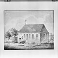
Nederlands: Ned. Hervormde kerk, Jannum - anno 12e eeuw - sinds 1947 kerkmuseum
This is a category about rijksmonument number 11688 |
Address
| Tsjerkestrjitte 4 Jannum Netherlands |
Media in category "Kerk, Jannum"
The following 62 files are in this category, out of 62 total.

Altaarsteen en deksel van een sarcofaag - Janum - 20120762 - RCE.jpg
880 × 1,200; 181 KB
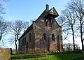
De Hervormde kerk, gezien vanuit het zuidoosten - Janum - 20534922 - RCE.jpg
1,200 × 870; 174 KB

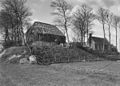
De Terp met kerkje en huisjes. Janum..JPG
2,308 × 1,731; 1.39 MB
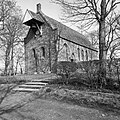
Exterieur - Janum - 20120739 - RCE.jpg
1,200 × 943; 311 KB

Exterieur - Janum - 20120740 - RCE.jpg
1,200 × 948; 313 KB
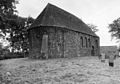
Exterieur noord-oost gevel - Janum - 20120756 - RCE.jpg
1,200 × 960; 370 KB

Exterieur vanuit het noord-oosten - Janum - 20120720 - RCE.jpg
1,200 × 886; 267 KB
Exterieur vanuit het noord-oosten - Janum - 20120738 - RCE.jpg
1,200 × 892; 252 KB

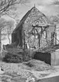
Exterieur vanuit het oosten met gedeelte afgegraven terp - Janum - 20120717 - RCE.jpg
1,200 × 824; 230 KB

Exterieur vanuit het westen en vanuit het zuid-westen - Janum - 20120731 - RCE.jpg
1,200 × 1,176; 454 KB

Exterieur vanuit het westen en vanuit het zuid-westen - Janum - 20120732 - RCE.jpg
1,195 × 1,200; 515 KB

Exterieur vanuit het zuid-oosten en vanuit het zuid-westen - Janum - 20120718 - RCE.jpg
1,200 × 825; 369 KB
Exterieur vanuit het zuid-oosten en vanuit het zuid-westen - Janum - 20120719 - RCE.jpg
1,200 × 834; 302 KB
Exterieur vanuit het zuid-westen - Janum - 20120723 - RCE.jpg
902 × 1,200; 208 KB
Exterieur zuid-west gevel - Janum - 20120752 - RCE.jpg
955 × 1,200; 321 KB
Exterieur zuid-west gevel - Janum - 20120753 - RCE.jpg
1,200 × 953; 400 KB
Exterieur zuidgevel - Janum - 20120754 - RCE.jpg
1,200 × 955; 341 KB
Exterieur zuidgevel - Janum - 20120755 - RCE.jpg
1,200 × 948; 313 KB

Gedeelte van gevel - Janum - 20120764 - RCE.jpg
1,200 × 886; 290 KB

Gedeelte westgevel - Janum - 20120768 - RCE.jpg
1,200 × 1,200; 545 KB
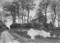
Gezicht op de terp - Janum - 20120716 - RCE.jpg
1,195 × 1,200; 383 KB

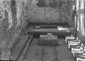
Interieur naar het oosten - Janum - 20120747 - RCE.jpg
952 × 1,200; 188 KB
Interieur naar het oosten - Janum - 20120757 - RCE.jpg
951 × 1,200; 198 KB

Interieur naar het westen - Janum - 20120758 - RCE.jpg
960 × 1,200; 198 KB

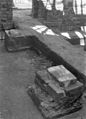
Interieur zerk nr. 17 afkomstig uit Rinsumageest - Janum - 20120770 - RCE.jpg
1,200 × 951; 338 KB

Interieur zerk nr. 18 tegen zuidmuur schip - Janum - 20120771 - RCE.jpg
946 × 1,200; 290 KB
Inwendig naar het oosten - Janum - 20120746 - RCE.jpg
891 × 1,200; 240 KB

Inwendig naar het oosten - Janum - 20120748 - RCE.jpg
1,200 × 893; 181 KB

Inwendig naar het westen en naar het oosten - Janum - 20120744 - RCE.jpg
1,200 × 828; 120 KB

Inwendig naar het westen en naar het oosten - Janum - 20120745 - RCE.jpg
1,200 × 831; 124 KB

Jannum tsjerke.jpg
236 × 176; 71 KB
Jannumer tsjerke.jpg
4,180 × 3,002; 6.19 MB

Janum Huisje en Kerkje op de Terp..JPG
2,592 × 1,944; 905 KB

Kerk van Jannum.jpg
2,080 × 1,944; 696 KB

Kerkje op de terp van Jannum..JPG
2,592 × 1,944; 983 KB
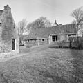
Kosterswoning - Janum - 20120769 - RCE.jpg
1,200 × 1,195; 445 KB

Noord en zuid-gevel - Janum - 20120721 - RCE.jpg
1,200 × 834; 303 KB

Noord en zuid-gevel - Janum - 20120722 - RCE.jpg
1,200 × 828; 295 KB

Noord muur - Janum - 20120728 - RCE.jpg
1,200 × 862; 357 KB

Noord portaal - Janum - 20120724 - RCE.jpg
902 × 1,200; 297 KB
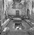
Ontgraving schip - Janum - 20120733 - RCE.jpg
1,181 × 1,200; 462 KB
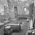
Ontgraving schip - Janum - 20120734 - RCE.jpg
1,197 × 1,200; 482 KB

Ontgraving schip - Janum - 20120735 - RCE.jpg
1,200 × 1,176; 444 KB

Ontgraving schip - Janum - 20120736 - RCE.jpg
1,192 × 1,200; 491 KB

Ontgraving schip - Janum - 20120737 - RCE.jpg
1,186 × 1,200; 471 KB
Ontgraving vloer - Janum - 20120741 - RCE.jpg
1,200 × 867; 279 KB
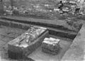
Ontgraving vloer - Janum - 20120742 - RCE.jpg
1,200 × 867; 328 KB
Ontgraving vloer - Janum - 20120743 - RCE.jpg
864 × 1,200; 227 KB
Overzicht - Janum - 20120725 - RCE.jpg
1,200 × 859; 356 KB
Overzicht - Janum - 20120726 - RCE.jpg
1,200 × 867; 423 KB

Overzicht - Janum - 20120751 - RCE.jpg
1,200 × 946; 409 KB
Overzicht - Janum - 20120767 - RCE.jpg
1,200 × 1,197; 514 KB
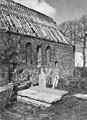
Overzicht van eenbeukige bakstenen kerk met grafstenen op de voorgrond - Janum - 20415630 - RCE.jpg
1,200 × 843; 277 KB
Preekstoel - Janum - 20120763 - RCE.jpg
868 × 1,200; 207 KB

Tekening gewelfaanzet portaal - Janum - 20120761 - RCE.jpg
879 × 1,200; 227 KB
Tekening van A. Martin. Origineel in Friesch Museum te Leeuwarden. - Janum - 20120766 - RCE.jpg
1,200 × 1,197; 225 KB

Tsjerke fan Jannum.jpg
4,480 × 3,045; 10.44 MB
West-gevel - Janum - 20120727 - RCE.jpg
863 × 1,200; 371 KB
Zuid muur - Janum - 20120729 - RCE.jpg
870 × 1,200; 377 KB

Zuid muur - Janum - 20120730 - RCE.jpg
886 × 1,200; 355 KB

Zuilbekroning - Janum - 20120759 - RCE.jpg
952 × 1,200; 241 KB
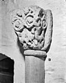
Zuilbekroning - Janum - 20120760 - RCE.jpg
960 × 1,200; 259 KB
Categories:
- Buildings in Jannum
- Churches in Noardeast-Fryslân
- Rijksmonumenten in Jannum
- Romanogothic churches in the Netherlands
- 1300s churches
(window.RLQ=window.RLQ||[]).push(function()mw.config.set("wgPageParseReport":"limitreport":"cputime":"2.000","walltime":"2.330","ppvisitednodes":"value":16952,"limit":1000000,"ppgeneratednodes":"value":0,"limit":1500000,"postexpandincludesize":"value":45227,"limit":2097152,"templateargumentsize":"value":14092,"limit":2097152,"expansiondepth":"value":25,"limit":40,"expensivefunctioncount":"value":7,"limit":500,"unstrip-depth":"value":0,"limit":20,"unstrip-size":"value":2853,"limit":5000000,"entityaccesscount":"value":10,"limit":400,"timingprofile":["100.00% 2301.702 1 -total"," 89.99% 2071.410 1 Template:Wikidata_Infobox"," 89.86% 2068.287 1 Template:Wikidata_Infobox/core"," 36.44% 838.836 214 Template:Wikidata_Infobox/line"," 15.12% 347.963 1 Template:Wikidata_ID"," 13.38% 308.019 1 Template:Br_separated_entries"," 12.43% 286.211 200 Template:Wikidata_ID_line"," 6.69% 153.950 3 Template:If_then_show"," 5.56% 128.024 1 Template:Ifcategory"," 4.91% 113.098 1 Template:Mapframe/Wikidata"],"scribunto":"limitreport-timeusage":"value":"1.248","limit":"10.000","limitreport-memusage":"value":6606191,"limit":52428800,"cachereport":"origin":"mw1263","timestamp":"20190415022521","ttl":2592000,"transientcontent":false);mw.config.set("wgBackendResponseTime":2640,"wgHostname":"mw1263"););


